Saindak copper–gold alteration map
Satellite mapping of the Saindak porphyry copper–gold mine, 15 km from the Iranian border. It uses NASA EMIT hyperspectral data on three dates, ASTER, Sentinel-2, Landsat back to 1990, and Google Earth Pro imagery from 1985 to 2026. Because the mine is operating, its known orebodies act as a built-in test of the method.
1 · Google Earth Pro imagery, annotated
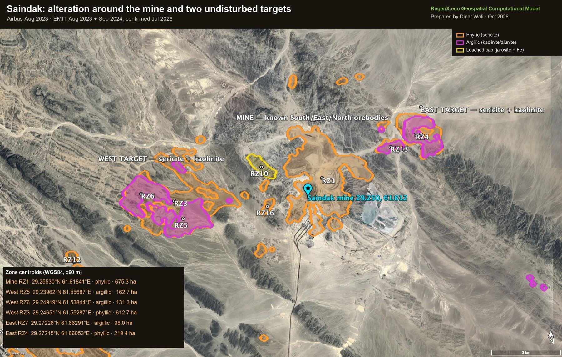
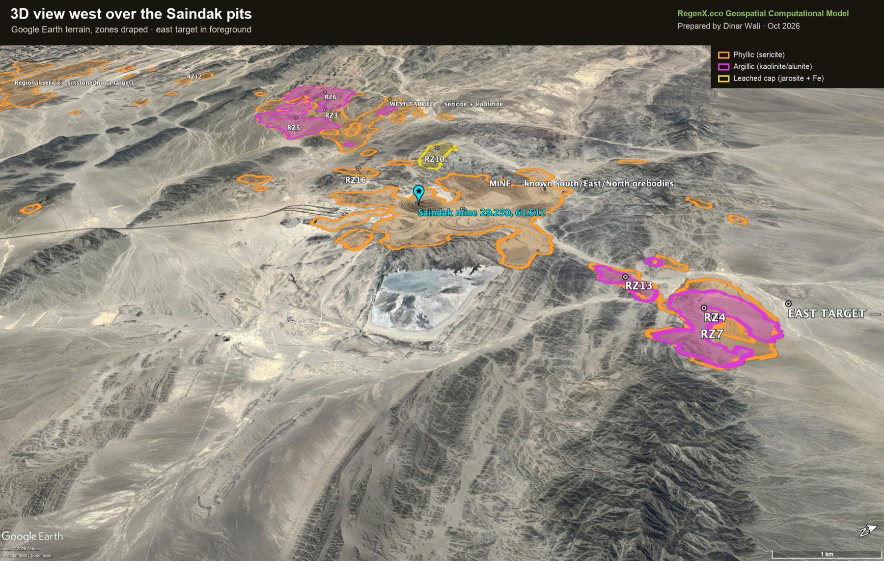
The alteration zones were loaded into Google Earth Pro as a KML and rendered by Earth on Airbus imagery of 28 August 2023, so every outline follows the terrain.
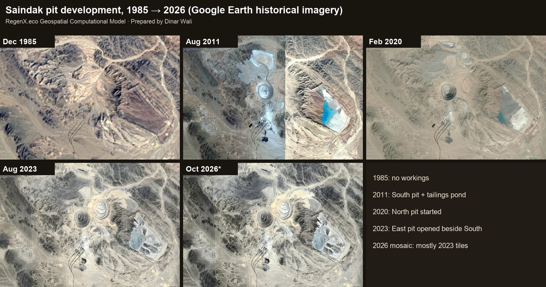
2 · Pit development, 1985–2026
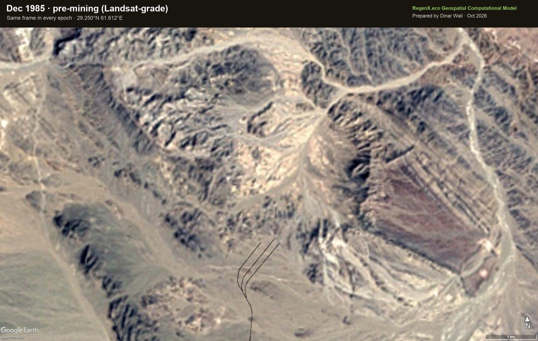
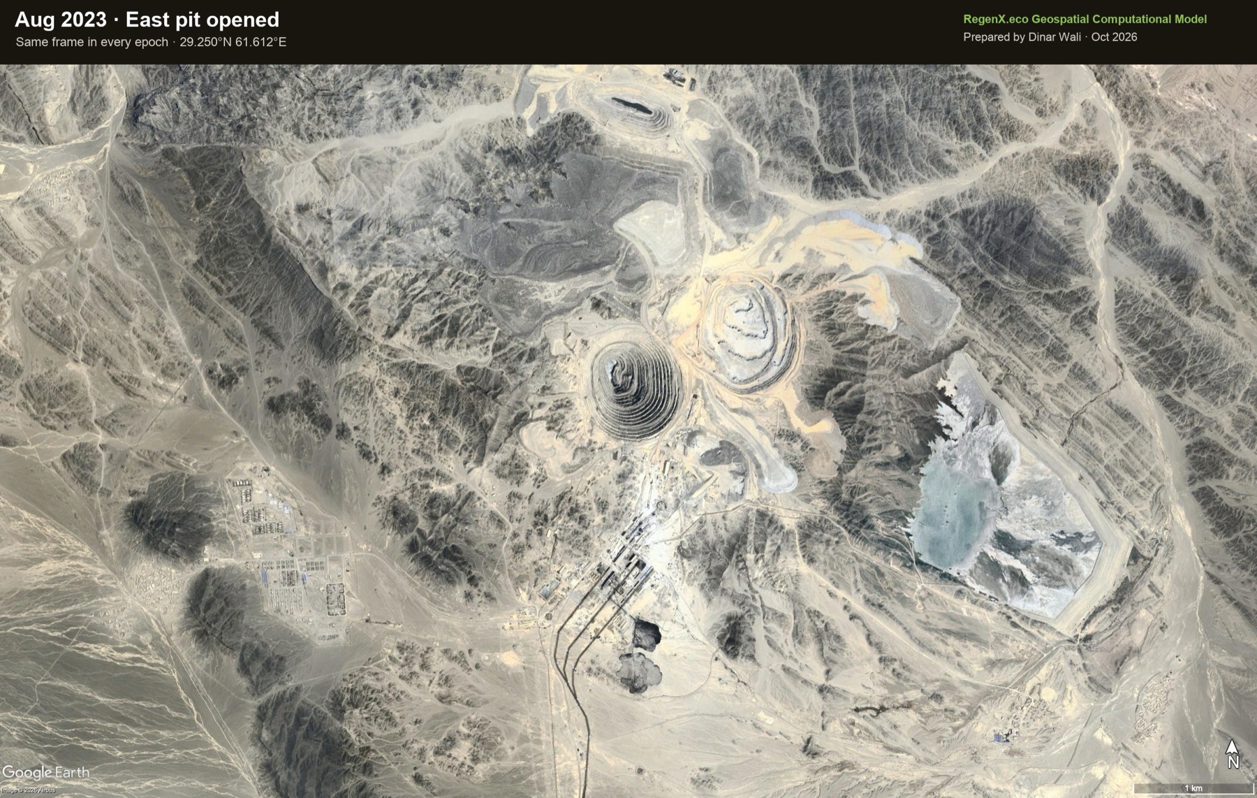 Dec 1985Aug 2023
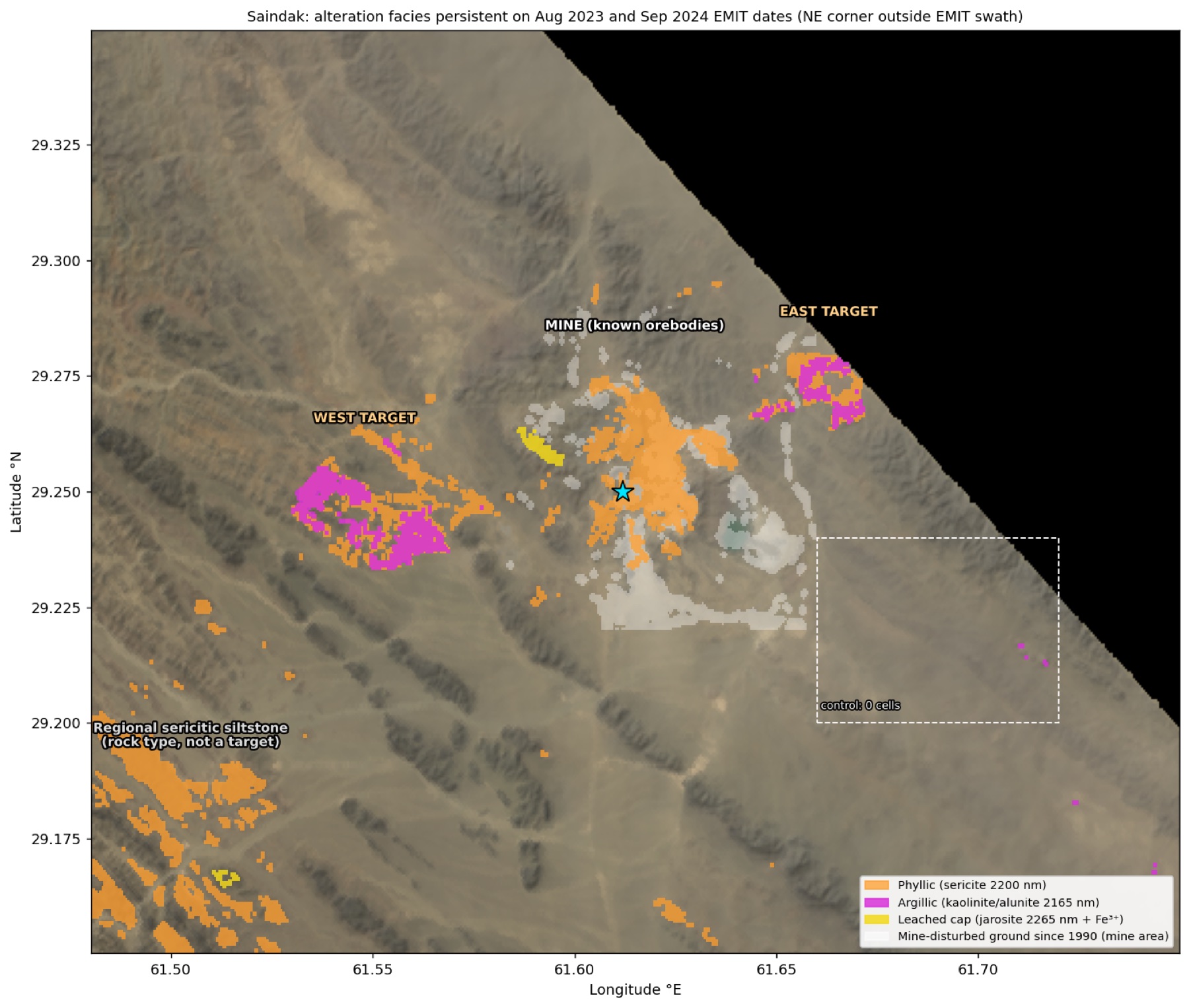
3 · Ranked alteration zones
A cell joins a facies when its absorption is at least 2.5 robust standard deviations above the scene on both the 27 August 2023 and 27 September 2024 EMIT dates. Coordinates are WGS84 centroids, accurate to about ±60 m. The south-west sericite belt is regional siltstone, the deposit's host rock, and carries no kaolinite, so it is shown as rock type and not as a target.
| Lat °N | Lon °E |
|---|
4 · Spectral evidence
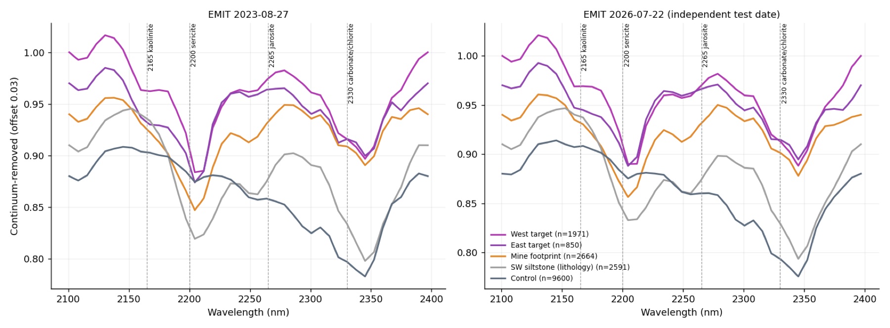
5 · Validation
| Group (independent date, 22 Jul 2026) | Sericite z>2.5 | Kaolinite z>2.5 | ASTER kaolinite z (2000) |
|---|---|---|---|
| West target | 91.4% | 53.3% | +2.37 |
| East target | 84.6% | 42.8% | +2.37 |
| Mine footprint (known orebodies) | 87.8% | 1.2% | +0.59 |
| Regional siltstone (rock type) | 78.5% | 0.0% | +0.34 |
| Control | 0.1% | 1.1% | n/a (no ASTER pixels) |
6 · Activity 2025–26 (Sentinel-2)
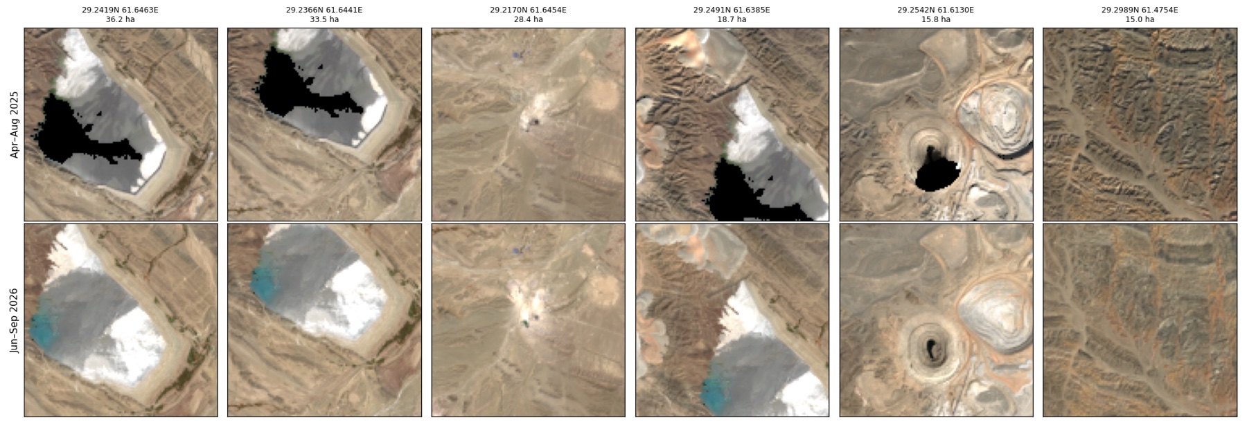
7 · Context
Saindak is a Miocene (about 22 Ma) tonalite-porphyry copper–gold deposit with three centres: South, East and North. They are hosted in Tertiary sandstone, mudstone and volcanic rocks, mainly Oligocene siltstone. The pre-mining resource is reported as 412 Mt at 0.45% Cu and 0.34 g/t Au (Ghaffar et al., 2016, via Porter GeoConsultancy). Per press reports, the South orebody held 111 Mt at about 0.43% Cu and the East orebody about 278 Mt. The Metallurgical Corporation of China (MCC) has operated the mine under lease since 2002, extended in 2023. Press coverage has reported the operator seeking a licence for a new exploration block to extend mine life, which makes undisturbed alteration outside the current pits directly relevant.
8 · Method and limits
Data.
- NASA EMIT L2B mineral ID (20 dates, 2022–2026).
- EMIT L2A reflectance: 27 Aug 2023, 27 Sep 2024, and 22 Jul 2026 as the independent test date.
- ASTER AST_07XT (2000).
- Sentinel-2 L2A: 14 scenes, December 2024 – September 2026.
- Landsat 5, 7, 8 and 9 (1990–2026).
- Copernicus GLO-30.
- Google Earth Pro imagery: December 1985, August 2011, February 2020, August 2023 and the October 2026 mosaic.
Rules carried over from Reko Diq, Hatoun, Bayan Obo and Chitral. A result must repeat across dates, stay clean on control ground and survive an independent test date. A second sensor must confirm it, and annotation is rendered by Earth on real terrain. New here: the operating mine itself serves as the positive control.
Limits.
- EMIT pixels are 60 m, and the north-east corner of the box is outside the swath.
- Copper minerals themselves are not detected.
- Alteration does not mean ore: the targets need drilling to test grade.
- Nothing here is an assay or a resource estimate.
Contact
I build geospatial computational models that measure what the ground is actually doing. I founded RegenX.eco in 2023 to turn open satellite archives into evidence that governments, lenders and developers can act on. We have applied the model to more than 30 sites across Pakistan, the UAE, Nepal and China, and every number ships with its formula, inputs and limits.
dinar.wali@regenx.ecoSources
- Porter GeoConsultancy: Saindak deposit summary. Location, geology, alteration, 412 Mt resource (Ghaffar et al., 2016).
- Saindak Copper Gold Mine, Wikipedia: operator and lease history.
- Dawn: project to close if new-block exploration licence not issued; Arab News: 15-year exploration lease; Express Tribune.
- Download the alteration KML for Google Earth · Code and data on GitHub
- Data: NASA EMIT and ASTER (LP DAAC), Copernicus Sentinel-2 and GLO-30, USGS Landsat. Google Earth Pro imagery © Airbus and Maxar Technologies.